Indiana
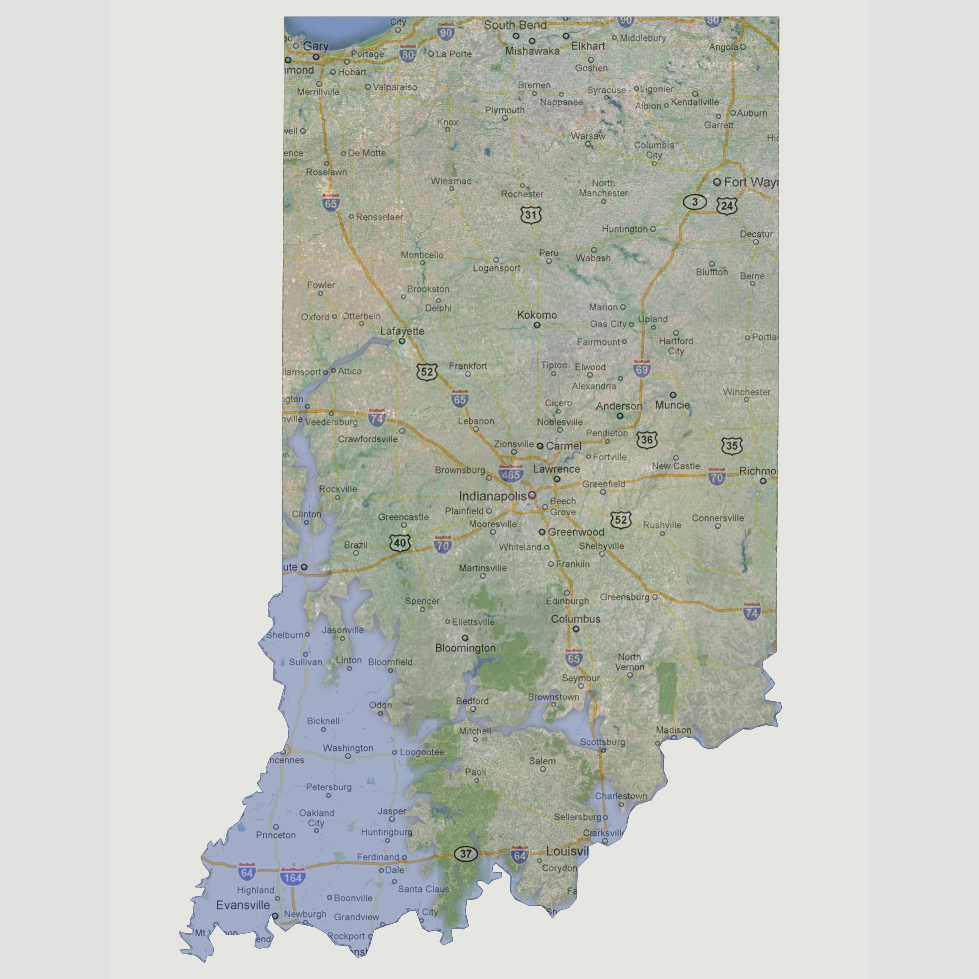
- 600 feet
The
Ohio River and White River would be inundating the lower, west portion
of the state. The areas of Evansville and Terre Haute would be underwater.
The water would travel east to the border of the Hoosier National Forest
up to Bloomfield and Clinton. There would also be a new river formed from
Scottsburg, through Bedford to Loogootee. There will be flooding along
the White River from Terre Haute to Lafayette.
© 2012