Montana
- 4,500 feet
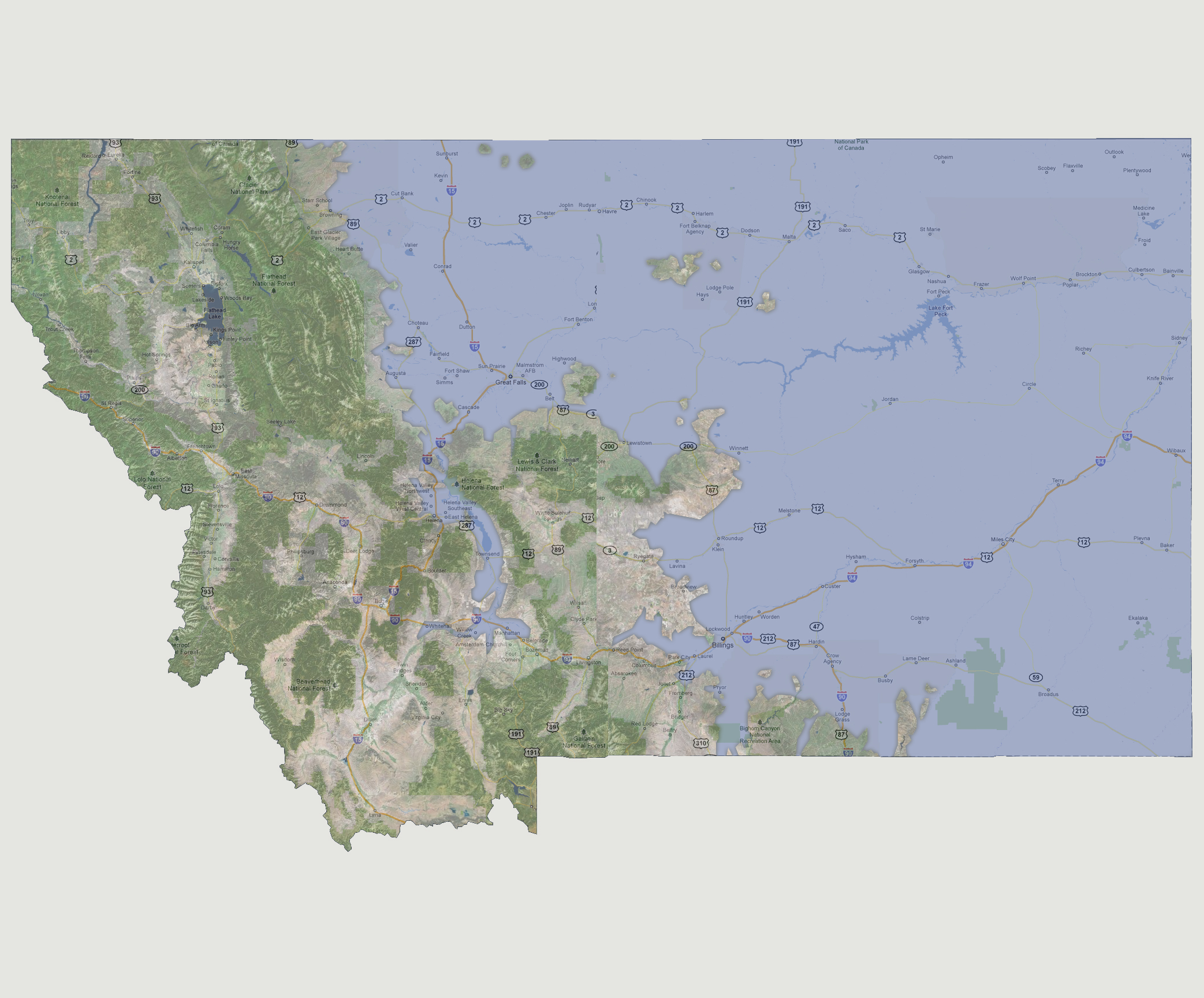
The
Missouri River has flooded its banks clean through to the Whitehall/Manhattan
area putting most of the state capital Helena underwater. Other areas
now flooded include Great Falls, Havre and Billings. The shoreline is
a meandering line from the eastern side of the Flathead National Forest,
then cuts to the east just north of the Lewis & Clark National Forest,
then south to Billings. Some of the Bighorn Canyon’s higher elevations
are fine as well.
© 2012