Illinois
- 300 feet
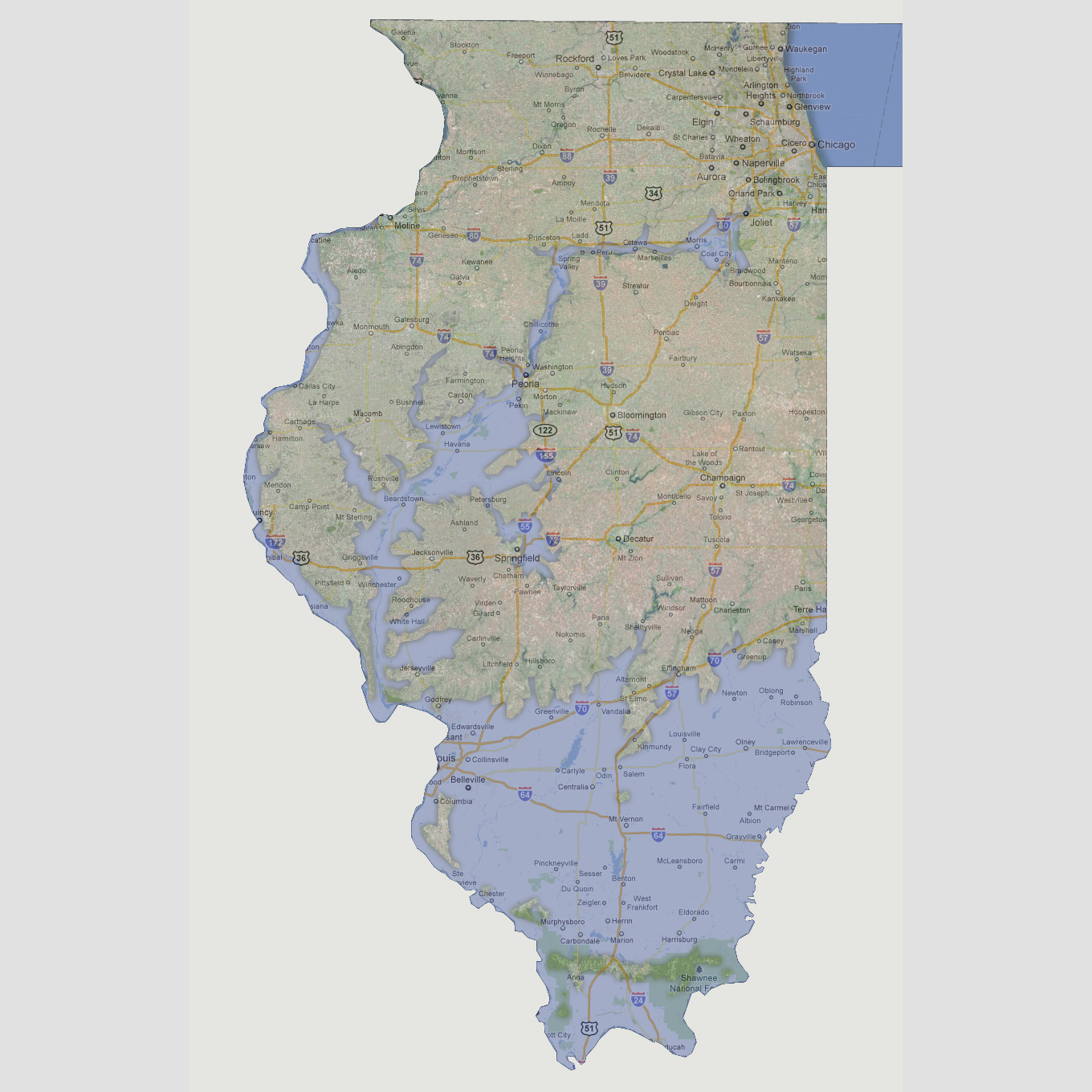
The
Ohio, Mississippi and Illinois Rivers will be impacting the state. Everything
south of Interstate 70 will be underwater except strip of land from west
border to east border in the Shawnee National Forest and a couple of small
islands. Following the Illinois River north, areas underwater include
St. Louis, Winchester, Beardstown, Petersburg, Havana, Lewistown, Peoria.
The River will also have localized flooding up through to Joliet. The
state capital Springfield will be on a small peninsula with all major
roadways surrounding the city underwater. The Mississippi River would
have localized flooding along the western border up through Moline.
© 2012