Missouri
- 600 feet
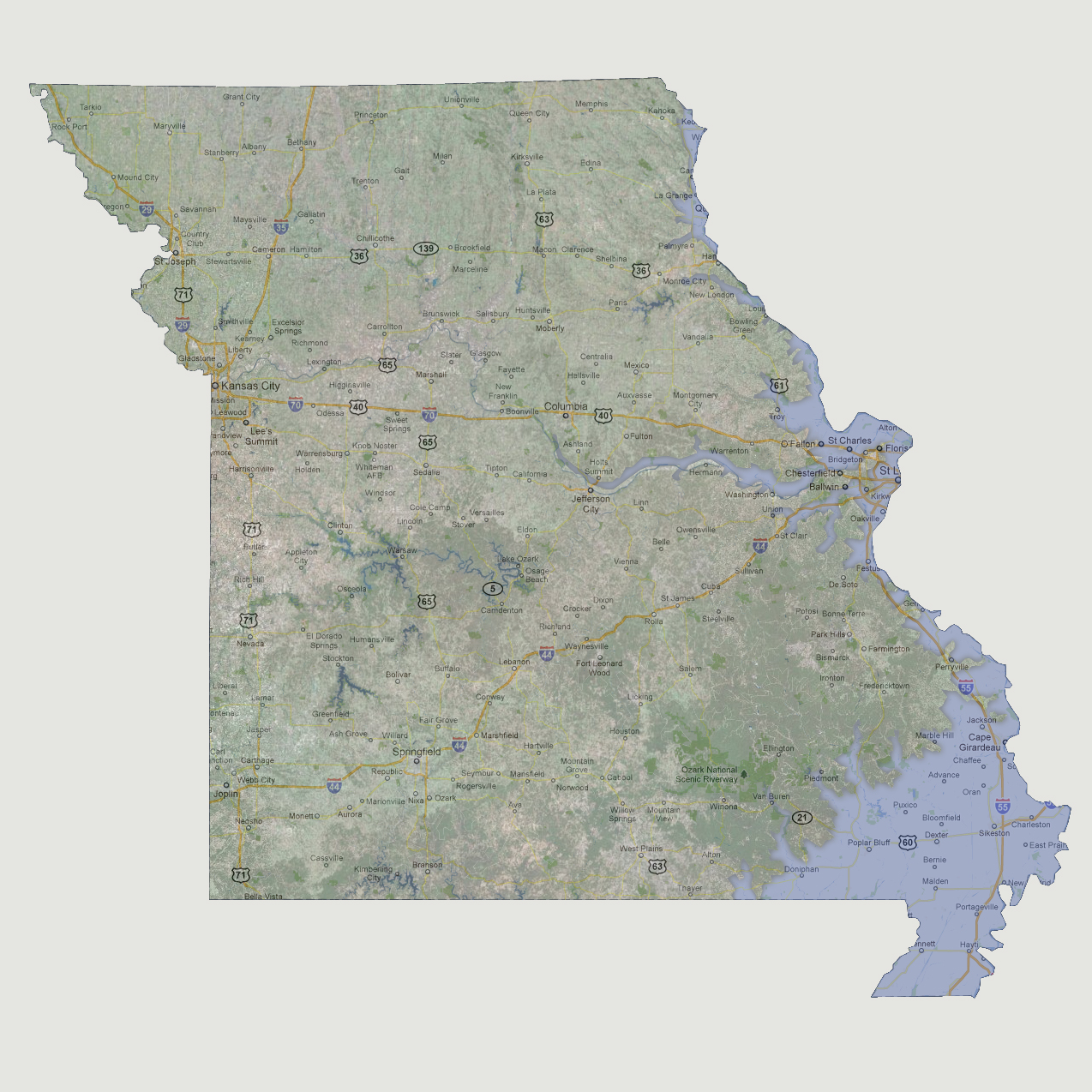
The
Mississippi River is flooding its banks all the way to the northern border
of Missouri, mostly affecting the southeastern portion of the state. Interstate
55 up through St. Louis is underwater. From Cape Girardeau southwest to
Doniphan are inundated. The Missouri River at St. Louis and west are flooded
and affect towns along the river almost to Columbia.
© 2012