Nevada
- 6,000 feet
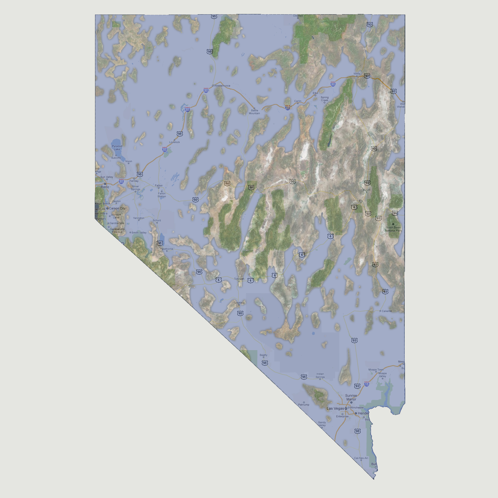
At
6,000 feet of sea level rise, the majority of Nevada is now flooded and
the state has become a group of islands. The largest island (which is
about one sixth the total land mass of the current state of Nevada) would
be made up of Ruby Lake National Wildlife Refuge, Great Basin National
Park and the towns of Ely and McGill down to the southern point of Tonopah.
Cave Lake State Park would also be attached to this island by a small
land bridge near Wells. All major roadways are now underwater along with
the areas of the state capital, Carson City and Reno. Lake Tahoe is also
above sea level as the lake surface is 6,223 feet above sea level.
© 2012