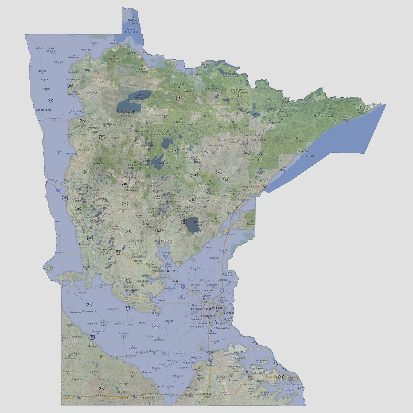

Minnesota
- 1200 feet
Between
700 and 1200 feet of sea level rise, the Mississippi River first would
start flooding the St. Paul area and spread up the Minnesota and Mississippi
Rivers. Lake Superior would follow flooding down and combining with these
rivers. Before hitting the 1200 foot mark, the Red River of the North
would also start flooding its banks up through Lake of the Woods. This
would leave a 70 mile wide path of destruction centered in St. Paul and
following the Minnesota and Red Rivers up to the northern border.
© 2012