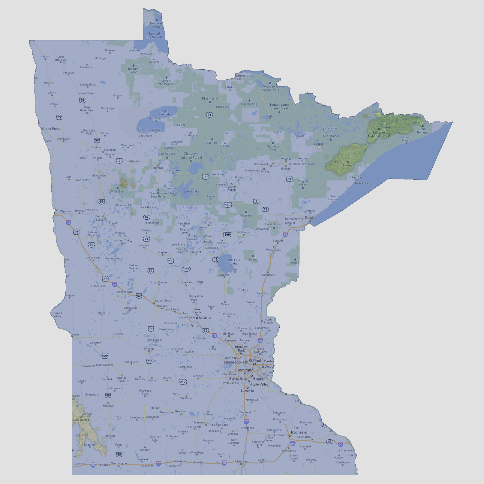
Minnesota
- 1800 feet
Only
3 areas would remain above water. The smallest being a cluster of 3 small
islands in the White Earth location, a slender land mass from Lake Benton
almost to Worthington and the largest, a group of islands in the northeast
border. This would be in the Superior National Forest and Finland areas.
Eagle Mountain is located here and is the highest point in Minnesota at
2,301 feet above sea level.
NOTE: The highest tsunami recorded was 1720 feet in Lituya Bay, Alaska.
© 2012