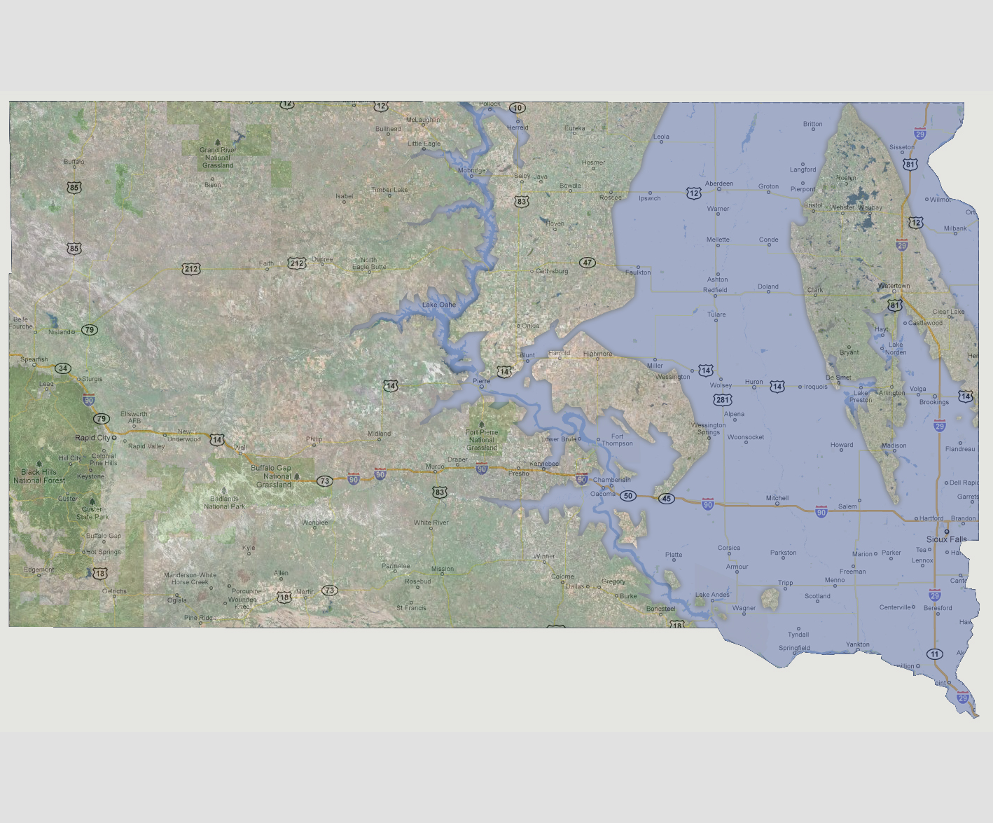
South
Dakota - 1800 feet
The
state is now majorly affected from the Missouri River east. The flooding
level has reached Lake Oahe which is causing bank flooding there. Three
large islands make up the land mass on the eastern half of the state.
Watertown is centered on a horseshoe shaped island which includes the
areas of Bryant, Arlington, Clear Lake, Roslyn and Clark. From Eureka
down to Onida make up the second island. The third and smallest island
is from Harrold to Wessington Springs.
NOTE: The highest tsunami recorded was 1720 feet in Lituya Bay, Alaska.
© 2012